

.png)
The Forts Trail in Genoa: a hike along ridges and historic fortifications above the city
Head up into the hills above Genoa and the landscape quickly changes. Ridge trails, meadows and old fortifications replace the busy streets of the city centre, while Genoa and the sea remain visible in the distance. This is where the Forts Trail in Genoa runs, one of the most interesting hikes you can do without travelling far from the city.
Starting from Righi, which is easy to reach by public transport, the route passes several fortifications built over the centuries to defend Genoa. The hike is worth doing not only for the views, but also for the chance to discover a lesser-known side of the city's history.
The Forts Trail: which route should you follow?
When people talk about the Forts Trail in Genoa, they are not actually referring to one single itinerary. The Parco Urbano delle Mura e dei Forti is crossed by several trails, making it possible to choose a shorter or longer route depending on how much time you have and your level of fitness.
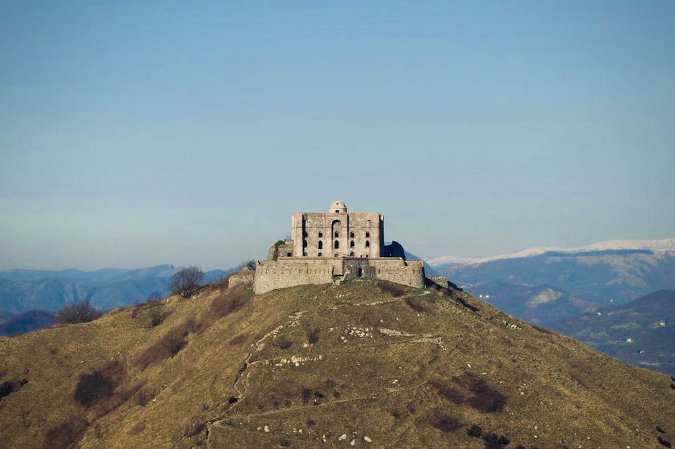
For visitors to Genoa, one of the most convenient starting points is Righi, which can be reached from the city centre by funicular. From here, the classic route climbs towards Forte Castellaccio and Forte Sperone, before continuing along the ridge towards Forte Puin and Forte Diamante, the highest and most isolated fort in the park.
This is the itinerary we will follow: a hike that can be adapted to the time available and alternates between dirt tracks and trails, with several viewpoints overlooking Genoa, the Bisagno Valley and the Polcevera Valley. Those who continue all the way to Forte Diamante should also allow for the final series of switchbacks leading up to the fort, at an altitude of around 660 metres.
For the route from Righi to Forte Diamante via Sperone and Puin, returning to the starting point, you should allow for around 9 km of walking, 400 metres of elevation gain and 3–4 hours of hiking. Distance and elevation gain may vary slightly depending on the trails and detours chosen along the way.
From Righi to the Genoa Forts: the main stages of the route
From Righi, the landscape gradually changes as you gain altitude and leave the city streets behind. The route follows the hills northwards, connecting some of the main fortifications that still dominate the ridges behind Genoa. The main landmarks along this section of the Forts Trail are Forte Sperone, Forte Puin and finally Forte Diamante, the highest point of the itinerary.
From Righi to Forte Sperone
Leaving Righi, the route climbs towards the Parco delle Mura along Via del Peralto. The first section takes you to the area around Forte Castellaccio and then on to Forte Sperone, at an altitude of 512 metres.
This was one of the key points in Genoa's defensive system. The fort stands at the top of Monte Peralto, exactly where the two branches of the Mura Nuove, or New Walls, meet. From here, the trail continues northwards, gradually leaving the more urban side of Genoa behind.
From Forte Sperone to Forte Puin
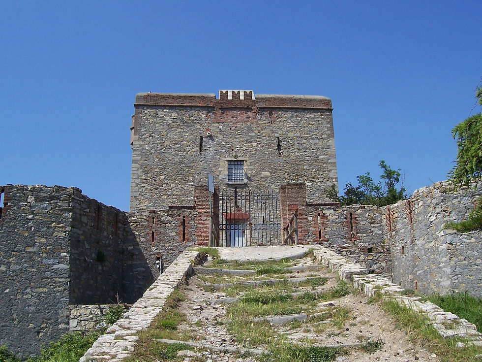
After Forte Sperone, the Genoa Forts hike continues along the ridge separating the Bisagno Valley from the Polcevera Valley. The next stop is Forte Puin, built in the 19th century to strengthen this section of the city's defensive line.
The fort stands at an altitude of around 500 metres and, thanks to its open position, is also one of the most panoramic points along the route. From here, the trail continues north, with the outline of Forte Diamante becoming the main landmark for the final part of the hike.
From Forte Puin to Forte Diamante
The final section leads to Forte Diamante, built on the summit of the mountain of the same name at an altitude of 667 metres. To reach it, you need to follow the distinctive military mule track, which climbs through 14 switchbacks before reaching the fort.
This is the highest point of our itinerary and also the furthest from the city. Its location was no coincidence: from here, the fort overlooked both the Polcevera and Bisagno valleys and provided an advanced line of defence against possible attacks from the north.
Once you arrive, it is worth stopping for a while before beginning the return journey. On a clear day, the view gives you a particularly good sense of just how much the surrounding hills and valleys have shaped both the development and the defence of Genoa.
The fortifications that protected Genoa from the hills
Walking from one fort to the next, it is natural to wonder why Genoa built so many defensive structures on the mountains surrounding the city. The answer becomes clearer when you look down at Genoa from above: squeezed between the sea and the hills, for centuries the city had to protect not only its coastline but also the routes leading in from the valleys behind it.
A fundamental part of this defensive system was the Mura Nuove, the New Walls, built along the ridges surrounding Genoa during the first half of the 17th century. Stretching for around 20 kilometres, they dramatically expanded the city's fortified perimeter, and sections of the walls can still be seen along the trails in the Parco delle Mura today.
Most of the forts encountered during the hike, however, belong to a later period. Between the 18th and 19th centuries, Genoa's defences were progressively reinforced with new fortifications built at strategic points in the hills. Forte Sperone, Forte Puin and Forte Diamante were all part of this network.
The result is quite unusual: just a few kilometres from the city centre, you can walk along what was once Genoa's defensive boundary. Looking at where the forts stand along the ridges also makes it much easier to understand why these particular locations were chosen.
An accessible hike, but proper footwear is essential
The Forts Trail does not require mountaineering skills, but it is still a proper hike. You will spend several hours walking on dirt tracks, mule paths and trails, with the climbs becoming more demanding as you approach Forte Diamante. The final section requires the most effort, as the old military mule track climbs through a series of switchbacks to the 667-metre summit of Monte Diamante, the highest point on the route. There are, however, no particular technical difficulties along the classic itinerary.
It is therefore best to wear hiking shoes or footwear with good grip and carry enough water and something to eat, especially if you plan to continue all the way to Diamante. Much of the route is exposed to the sun, so on hotter days it is better to start in the morning and avoid the middle of the day. In bad weather, it is always advisable to check trail conditions before setting off.
From central Genoa to Righi: planning your journey there and back
One of the advantages of this hike is that you do not necessarily need a car to reach the starting point. From central Genoa, you can take the Zecca–Righi funicular, which leaves from Largo Zecca and reaches the hills in around 12 minutes, climbing almost 280 metres along the way.
The funicular is part of Genoa's AMT public transport network and normally operates every day. Timetables and any service changes can be checked directly on the official AMT website before setting off.
For guests staying in the rooms at Hotel Astoria Genova, the Forts Trail can therefore be easily included in a stay without having to arrange a trip outside the city. From the hotel, you can reach the city centre by public transport and then take the funicular from Largo Zecca directly up to Righi.
For the return journey, the simplest option is to retrace part of the route towards Righi and take the funicular back down. If you choose a different variation or continue beyond Forte Diamante, it is worth planning the entire route and your return point in advance, as both distances and walking times can vary considerably.